DESCRIPTION
West Pond has been one of the
most reliable locations around Yuma to hear, and occasionally
see, Black Rail. Other rails, bitterns, and waterfowl
also use the marshes and open water of West Pond. The
desilting ponds provide a safe refuge for waterfowl throughout
the winter season, and one of the most reliable places to see a
large number of duck species.
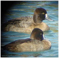
Lesser Scaup
|
DRIVING
DIRECTIONS
Site #11 on the Yuma
County Map
Getting here from the intersection of 1st Street and 4th
Ave takes
30-45 minutes:
- Drive north .8 miles on 4th Ave
across the Colorado River Bridge to the turn-off for California Highway
S-24 (Pichacho Recreation Area)
- Turn right and go north on S24 (veer left to follow it under the RR
bridge)
- Follow S24 as it winds its way through Bard
- After 12 miles you'll be at the Colorado River and then at Laguna Dam,
which is across from Betty's Kitchen
- At 17.8 miles you'll be at the turn-off to Senator Wash and West Pond --
turn left
- From this intersection travel west--immediately after crossing the All
American Canal turn right to reach West Pond.
- From S-24 it is 1.2 miles to McKinnley Road, which takes you to the
north side of West Pond and Imperial Dam. Turn right here.
- .4 miles down McKinnley Road is a dirt road that turns off to the right
and gives great access to the north side of West Pond
- .9 miles down McKinnley Road gets you to the Desilting Ponds --
park at the gates here
- From CA Hwy S-24 it is 2.5 miles to Senator Wash
|
BIRDING
SUGGESTIONS
(Numbered
spots correspond with the map on the right.)
1) West
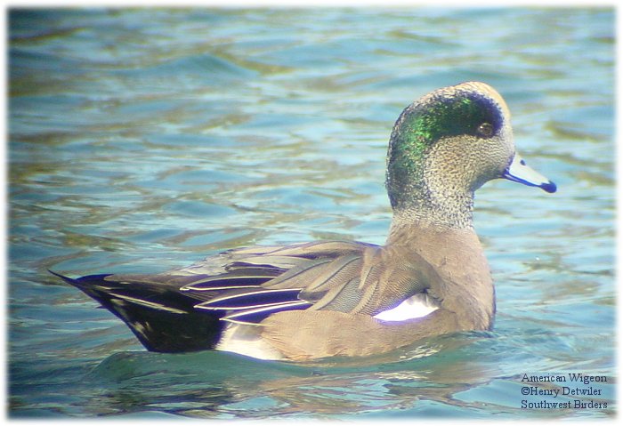
Pond - This overlook is great for waterfowl, including American
Pelicans during some winters. American Wigeon, Neotropic
Cormorant, and Barrow's Goldeneye are some of the birds that
have shown up here.
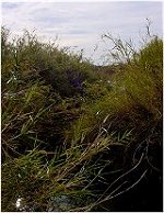
2) West
Pond - Black Rails are sometimes heard and infrequently seen in
the bulrushes at this corner of the lake. In April &
May, you may have luck at any time of the day, during other
months try it very early or at dusk.
3) West
Pond - All rails have been heard here - this dirt road cuts off
Mckinney Road at .5 miles and dead ends at the lake -- it is
often flooded. Also at the end of this road you may flush
both bitterns and waterfowl.
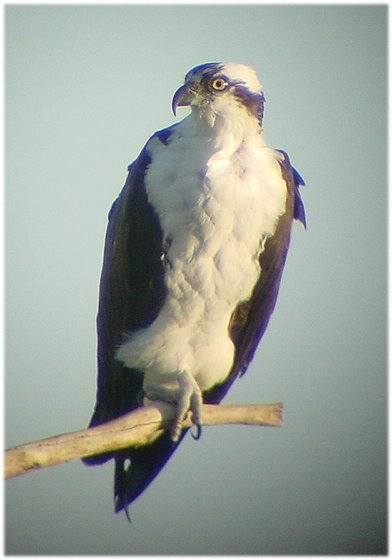
4) Desilting
Ponds - Park at the gate and walk in to look over these
concrete-lined ponds which are used to remove silt from the
water before it enters the All-American Canal. In the
winter there are many species of waterfowl and a few gulls. You can
almost always find Osprey here! 5)
Phil
Swing Park - During migration and sometimes in winter you
may find a rarity here. Gray Flycatcher, the odd sparrow,
and a Rufous-backed Robin have all shown up here. 6)
Palm
grove - check for Barn Owls, Gila Woodpeckers, and Hooded
Orioles in the summer 7)
See Imperial
Dam Page |
Imperial
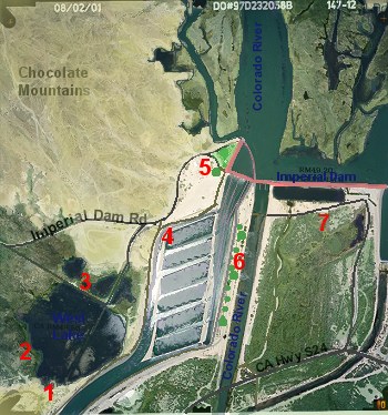
Dam, West Pond, & Desilting Ponds
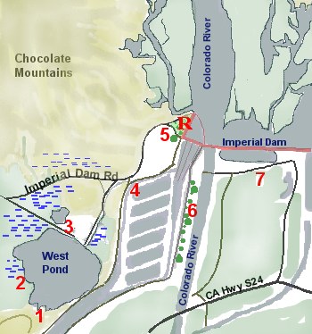
(Click
on the map for aerial photo)
|
Red numbers
correspond to
the birding suggestions on the left
Blue areas are water (canals, rivers, ponds, marshes, etc.)
- - - shows
marshy areas
Green
dots are trees
R
= rest room (at location #5, Phil Swing Park) |
|
