INTRODUCTION
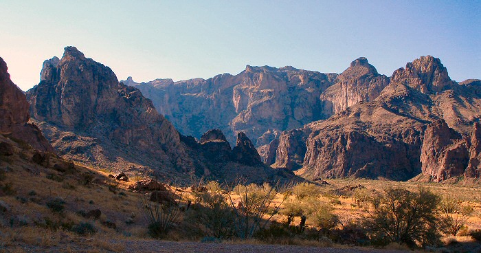
Springtime in the Kofas. Carpets of wildflowers, stark
and dramatic landscapes, the highest peak in southwest Arizona,
sweeping views over the desert, and then there are the birds! A
few of the birds in this canyon cannot be found anywhere else in
Southwest Arizona, or even in neighboring California. Some of
these birds can be seen more easily in Southeast Arizona, but not
against this dramatic backdrop of the Kofa Mountains. Cut
through beautiful reddish volcanic rock called rhyolite, eroded by
water and wind over time, scenic canyons and towering peaks
surround you at every turn. Signal Mountain is the highest peak
in southwestern Arizona, at 4877 feet.Camping
is a fine way to experience this area to the fullest extent. The
black desert sky will open up a glorious expanse of unbelievably
bright stars. And looking at them with your binoculars or scope
will reveal depths in the sky invisible to the naked eye. Even
without a moon, you can see the edges of the canyon walls
silhouetted against the sparkling constellations of the night
sky. But please don’t camp within ¼ mile of water holes (like
Cereus Tank)—that’s prohibited for the sake of wildlife. To
serenade you to sleep, Elf Owls will cackle and Western
Screech-Owls will whistle, all while Poorwills give their mournful, two
syllable “poor-will” call.
If you spend the night in the canyon, or
drive in early, you’ll be treated to a symphony of bird song as
dawn breaks over the canyon walls: whirring Rock Wrens, the
descending tremolo from a Canyon Wren, plaintive
calls of the Phainopepla and Canyon Towhees, melodious Scott’s
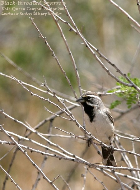
Orioles, and tinkling Black-throated Sparrows, to name but a few.
Over the course of several spring-time visits, we've seen 52
species here. A loose rock clattering down a ledge could be a sign that Desert
Bighorn Sheep are on the move—they’re fairly common around Signal
Mountain, so keep scanning the mountainsides to get a glimpse.
Link
to see my Birder's World article on Kofa Queen Canyon.
|
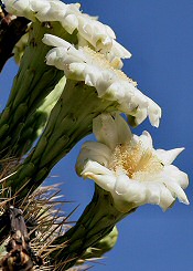
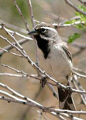
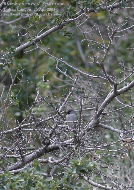
Saguaro Blossoms
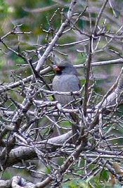
Black-chinned Sparrow
Click on
thumbnail pictures
to see full-sized photos.
|
|
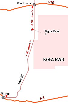
(Click on map for larger version) |
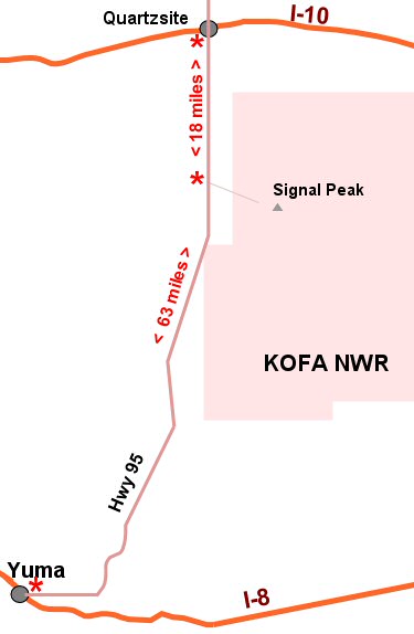
DRIVING
DIRECTIONS TO KOFA NWR Site #17 on Yuma
Area Overview Map
Kofa National Wildlife Refuge (NWR) is composed of 665,400 acres of upper Sonoran
desert northeast of Yuma, AZ.
- From Yuma, drive east and north on Highway 95 for 40 miles
to reach the first publicly accessible point of the refuge—Caste
Dome Road.
- To reach the Palm Canyon turnoff (which takes you to Kofa
Queen Canyon), drive Highway 95 for 63 miles beyond the I-8 & 16th
Street intersection.
- To reach the same Palm Canyon turnoff from Quartzsite, drive
south 18.7 miles on Highway 95.
|
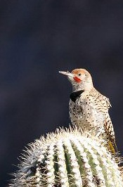
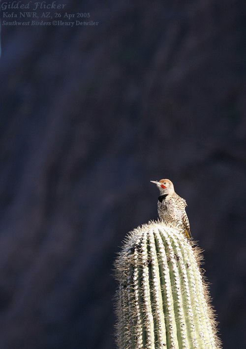
Gilded Flicker
|
|
HWY 95 to KOFA Queen Canyon
Driving Guide
- 0 miles: head east on the gravel road to
Palm Canyon. If you drive to the end of this road, you’ll end up
in 7.3 miles at the parking lot for Palm Canyon, which is best known for
its small stand of native California Fan Palms (one of but a few
such groves in Kofa NWR, and the only ones left in Arizona).
- 3.3 miles: turn left on the gravel road to Kofa Queen Canyon

Looking east towards Signal
Mountain
- 7.9 miles: short road leads up to the right
to a fine camping spot overlooking the bajada stretching west to
Hwy 95
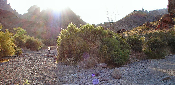
- 8.0 miles: you’re at the mouth of Kofa
Queen, guarded on the south side by a large monolith. This
feature may be the nesting site of a Prairie Falcon, which can
often be seen or heard calling from the summit.
- 8.0+ miles: you’ll be navigating the most
suitable path through the wash—follow the tire tracks. Stop often
to look for Black-throated Sparrow, Black-tailed Gnatcatcher and
Canyon Towhee in the brush, Gilded Flicker in the huge saguaro
cacti, showy Scott’s Oriole in the red-blooming ocotillos,
hummingbirds in the flowering chuparosa (Anna’s, Costa’s,
Black-chinned, & migrant Rufous & Calliopes), Cactus Wren in
the chollas, and Canyon Wren in the cliff-side boulders.
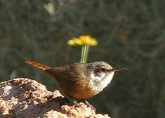
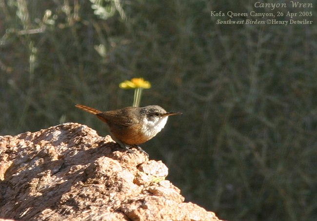
Canyon Wren
- 10 miles: you’ll see the
ridge & spire ahead of you, and a narrow wash entering the canyon
on your left (north side). This is Cereus Wash, and leads
uphill for about half a mile to Cereus Tank, a man-made watering
hole for sheep and other wildlife. Look in the trees for Lesser Goldfinch, Phainopeplas,
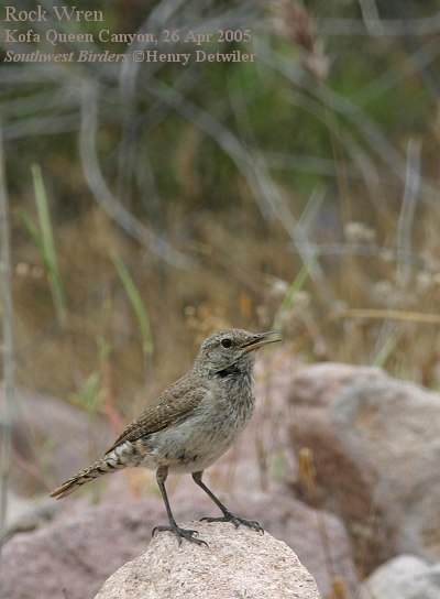
and in the surrounding rocks for Rock Wrens.
|
In
this canyon, as well as others, you may hear the descending trill
of the Canyon Wren, or get a glimpse of this handsome
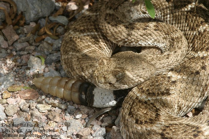
white-throated, chocolate-colored songster. One spring evening I
had excellent looks at two Western Diamondback rattlesnakes
in this wash.
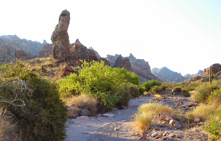
Cereus Wash goes off to the left; the base of the Needle is at
the upper right
- 10.1 miles: a rocky spine juts out from the
north side of the canyon, with a prominent spire sitting atop it.
An overhanging rock shelter and a partial rock wall point to its
use in historical times. It’s a good landmark, and a fine spot to
camp.
Gravel track & the Needle--
looking west into Kofa Queen Canyon
- 10.7 miles: here on the south side a major
drainage flows into the canyon. Indian Wash collects run-off from
Ten Ewe Peak, Signal Mountain, and other peaks, and funnels it
down into Kofa Queen Canyon. The mouth of Indian Wash here is the
start of the hike up to Signal Mountain saddle described below.
- 11.3 miles: A small jumble of rocks jut out of
the canyon where it widens out, with metate depressions in the smooth flat surface.
This is another good wide spot in the canyon to camp.

Metate Boulders
- 11.8 miles: End of the line for vehicles. Continue hiking up this road past the gate to reach the old Kofa Queen Mine, which was
in production during the late 20th century. |
|
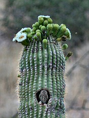
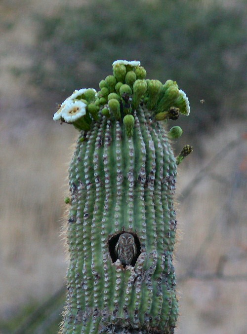
Elf Owl in Saguaro Nest
Cavity
|
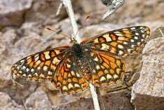
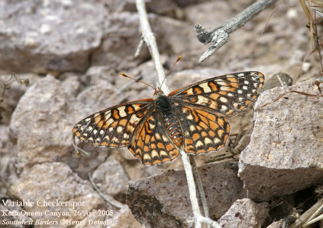
Variable Checkerspot |
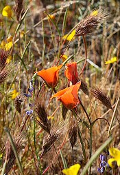
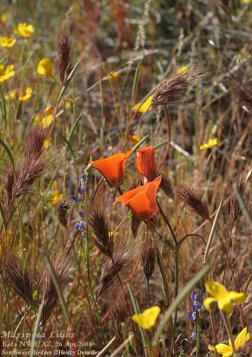
Mariposa Lilies |
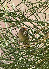
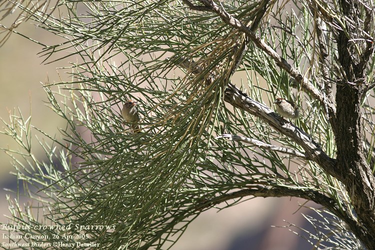
Rufous-crowned Sparrow |
|
(Click on map for larger version)
This morning
view is from Kofa Queen Wash--
looking south towards Ten Ewe Peak.
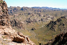
Looking north from the Saddle--
back down
Indian Canyon to Kofa Queen Canyon
|
Indian Canyon Hike
You can hike almost anywhere in Kofa Queen
Canyon, but to see some of the best wildflower displays, and a
couple of the target birds, consider a trip up Indian Wash &
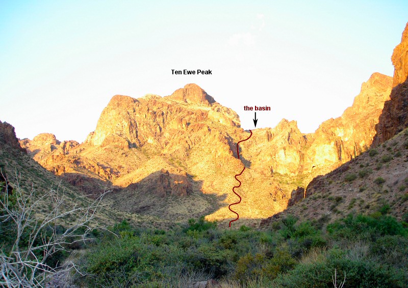
Indian Canyon, traversing the side of Ten Ewe Peak, that takes you
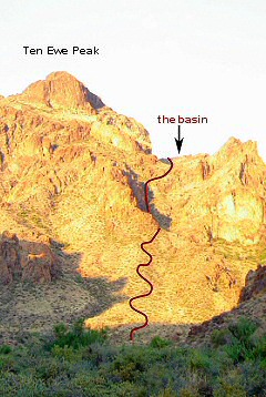
to the saddle and basin below Signal Mountain. See the trail
outlined on the photo to the left. Keep following
the trail all the way to the top, and you’ll be treated to views
of California, Arizona, and all the surrounding ranges.
-
About a quarter mile in, you'll come to a "Y"
in the wash (at the base of the squiggley
trail on the map), with Indian Wash coming in from the southwest, and
Ten Ewe Wash coming in from the southeast. At this point,
you'll hike up out of the wash, heading due south. This
gentle grade will head up the west side of Ten Ewe Peak.
This is the portion of the hike that will be awash in showy
flowers during the early spring following a wet winter.
-
The gentle grade up this hillside becomes
less gentle, and you'll encounter your first switchbacks as you
scramble uphill (see picture at left). Watch out for fierce cactus spines waiting
for the unwary.
-
Once you cross over to the west side of Ten
Ewe Peak, your ascent will once again be more gradual, and you’ll
start encountering Scrub Oak and many more shrubs. Early in
the spring mornings this is where you should listen for the songs
& calls of the Black-chinned and Rufous-crowned Sparrows.
-
Up along the higher portions, you may be “buzzed” by
White-throated Swifts hawking for insects, an exhilarating
experience if it doesn’t startle you too much! Keep looking up in the sky and you may be fortunate enough
to see a Golden Eagle soaring on the thermals. More common
are American Kestrels & Red-tailed Hawks, and Turkey Vultures.
-
The saddle is half the way up to the peak of
Signal Mountain, and makes a fine vantage point from which to
admire Indian Canyon and take a break. A basin (see
picture at left) on the south
side of the saddle has a fair growth of oaks, and a corresponding
variety of birds. Look here for flycatchers, sparrows, and
warblers. We've never gone past this wooded basin, but the
rest of the hike to the top of the peak can be done in another two
hours.
|
POSSIBLE
SIGHTINGS
During the winter the days are mild and the nights cold.
Look for residents and winter visitors such as:
- Prairie
Falcon (p)
- Gambel's
Quail (p)
- Greater Roadrunner (p)
- White-throated Swift (p)
- Gilded Flicker (p)
- Ash-throated Flycatcher (p, most common in spring)
- Verdin
(p)
- Canyon Wren (p)
- Rock Wren (p)
- Black-tailed Gnatcatcher (p)
- Blue-gray Gnatcatcher (w)
- Curve-billed Thrasher (p)
- Crissal Thrasher (p)
- Loggerhead Shrike (p)
- Western Scrub-Jay (r)
- Phainopepla (p)
- Curve-billed Thrasher (p)
- Brewer's
Sparrow (w)
- Canyon Towhee (p)
- Green-tailed Towhee (w)
- White-crowned Sparrow (w)
- Lesser Goldfinch (p)
Regularly
occurring spring migrants include:
- Rufous &
Calliope Hummingbirds
- 8 species of western wood warblers
- Dusky, Hammond's, & Pacific-slope Flycatchers
- 4 species of swallows
Spring & summer
residents start to trickle in during March. However, April and early
May are the best times to look for:
- White-winged Dove
- Elf Owl
- Western Screech-Owl
- Common Poorwill
- Lesser Nighthawk
- Hooded, Bullock's, & Scott's Orioles
- Black-chinned Sparrow
- Rufous-crowned Sparrow
p = permanent
resident
w = winter visitor
r = rarely seen or irregular
|
Black-throated Sparrow
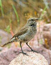
Rock Wren
|
|
PRECAUTIONS
Be prepared. This is a remote desert area
without drinking water—take 2 gallons of water per person per day. Let someone know your schedule,
and realize that there is no cell phone coverage within the
canyon. You can take a passenger car to the Palm Canyon
parking lot, but you'll need high clearance to get to, and into,
Kofa Queen Canyon. Summer time is best avoided, when daily temperatures
often soar above 110, and the birds seem to have disappeared in
the shimmering heat waves. Spring is usually mild, but you
should be prepared for rain, heat, and cold. Feb through
April are usually best for wildflowers, and April is the best
time for birds.
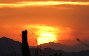
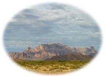
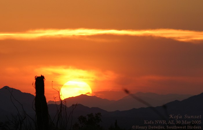
Sunset over the Kofas
|
LINKS
Additional
web pages with photos and info about KOFA Queen Canyon and
KOFA NWR.
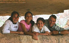
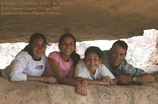
Veronica, Adriana, Gaby, &
Henry at the base of the Needle
|
|


